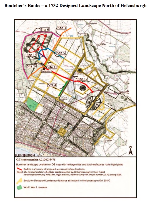
The map you see here is a Designed Landscape by William Boutcher dated to 1732 of the land of Malligs, before it was laid out as Helensburgh.
The existence of the Designed Landscape, which is evident on the slope of Tom na h-Airidh to the north of Helensburgh. was recognised by local historian Alistair McIntyre, and subsequent map analysis and field survey by local archaeologist, Fiona Baker, confirmed its existence.